Blueprint Subsea is a British manufacturer of state-of-the-art acoustic sensors for oceanographic, hydrographic and diving applications. The company’s range of commercial-off-the-shelf (COTS) products includes side-scan sonars, ultra-short baseline (USBL) positioning / tracking systems, modems, handheld diver sonar and navigation aids.
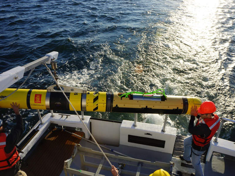
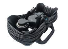
StarFish side-scan sonar
The StarFish range has gained worldwide recognition as the most compact, affordable, towed side-scan sonars for the professional underwater survey industry. All systems have been specifically designed for single-person deployment in shallow water, making them ideal for port and harbour survey and security work, inland water survey of rivers / canals / lakes, wreck location and search-and-recovery (SAR) missions.
At less than 15in long, the StarFish excels in remote shallow water locations where other side-scan systems struggle to perform. StarFish systems have been designed to be ‘plug and play’, connecting to your PC/laptop via a top-box with USB connection. The intuitive StarFish Scanline software, designed for Windows operating systems, has an easy-to-use interface with helpful instructions to get you started.
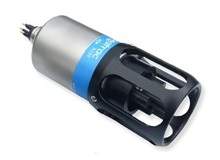
SeaTrac USBL tracking system and modems
SeaTrac is a range of micro-USBL tracking, positioning and modem systems designed for remotely operated underwater vehicles (ROVs), autonomous underwater vehicles (AUVs) and divers. Built around a robust broadband spread spectrum signalling scheme, the acoustic transponder beacons are capable of simultaneously tracking asset positions and undertaking bi-directional data exchange. When used in a tracking application, one X150 beacon is mounted from the supervisor vessel, and connected to a PC running the SeaTrac NavPoint display and logging software. All positions are computed by the X150 beacon, so no additional hardware is required.


Sub-surface assets to be tracked are fitted with an X110 beacon, and optionally may use the data port to provide periodic acoustic communications with other systems and sensors. In this mode up to 14 beacons may be tracked at ranges up to 1.5km from the supervisor, with the position of each being optionally broadcast to others in the network. Each beacon is fitted with a 9 Degrees-of-Freedom (DOF) Attitude and Heading Reference System (AHRS), taking data from the onboard MEMS gyroscope, accelerometer and magnetometer to produce pitch, roll and yaw information that is made available to external applications via the communications port.
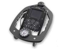
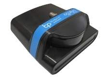
Artemis handheld diver sonar and navigator
Artemis is a modular handheld console, configured as a diver target detection sonar and GPS underwater navigation aid. Primarily designed to assist commercial and search-and-rescue divers in localising and relocating objects on the seabed, Artemis has also been specifically optimised for use by naval mine clearance and EOD divers to relocate items of ordnance. Artemis is intuitive and straightforward to use, as the interface has been designed by divers for divers. The user can quickly interpret information presented via the simple menu interface and graphical display. Sonar, navigation and other apps are selected and controlled via a simple five-button interface.
Synchronised software and navigational tools
Prior to diving, the Artemis Manager PC software application allows the creation of ‘mission’ files, containing navigation waypoints that the diver can choose as destinations during the dive. When the diver enters the water, an integrated immersion sensor automatically detects the start of the dive and starts logging data from the sonar, navigation system and other sensors into a ‘Dive-Log’ file. Additional navigation markers can also be added to the log-file by the diver as they encounter other targets or locations of interest.
After the dive, using the ‘plug-and-play’ USB connection, data can be transferred from the internal flash storage on Artemis and a Microsoft® Windows® based PC or laptop. The Artemis Manager software then allows reviewing of the dive-log data, synchronising the sonar imagery with the diver’s position and heading on a navigational chart. Data can be exported in a variety of formats for further use and analysis by third-party software applications.