
The UK’s new maritime security strategy has called for an improvement of seabed mapping less than two months after a 25% numerical cut of its ocean-going naval hydrographic survey fleet following the decommissioned of HMS Echo in June this year.
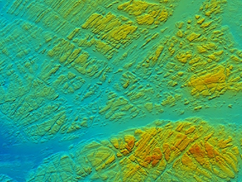
Released on 15 August, the UK’s maritime security strategy laid out a series of targets the UK Government would meet in the next five years, including improving the ‘quantity and quality’ of seabed mapping in order to identify potential future threats.
Go deeper with GlobalData

Discover B2B Marketing That Performs
Combine business intelligence and editorial excellence to reach engaged professionals across 36 leading media platforms.
According to the strategy, the term ‘maritime security’ will be updated to include the upholding of ‘laws, regulations and norms to deliver a free, fair and open’ maritime domain. The approach will see illegal, unreported and unregulated fishing and environmental damage as a maritime security concern.
In addition, UK Government has established the UK Centre for Seabed Mapping, which will be administered by the UK Hydrographic Office (UKHO), itself a trading fund of the UK Ministry of Defence (MoD). The UKHO’s ADMIRALTY maritime data solution set is used by private companies and countries around the world, providing marine geospatial data for use in the civil and military sectors.
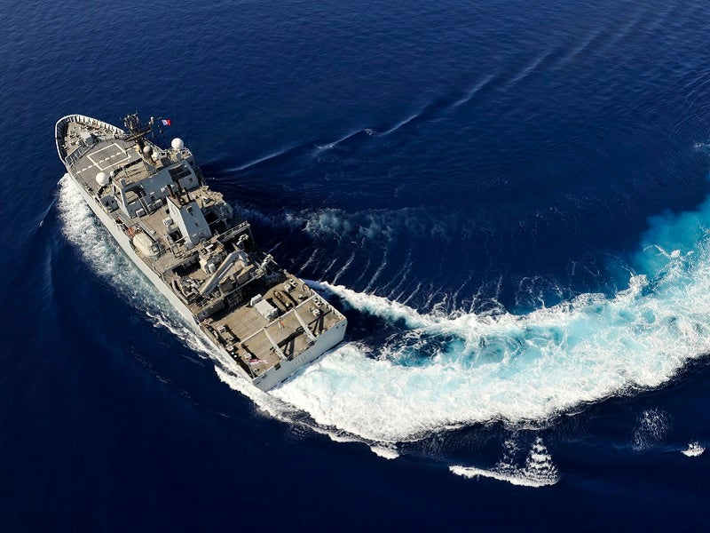
The Royal Navy (RN) contributes to the UKHO through its fleet of ocean-going survey vessels, currently comprised of the HMS Scott (commissioned in 1997), HMS Enterprise (commissioned in 2003), and the Antarctic patrol ship HMS Protector, a civilian ice survey vessel built in 2001 and acquired by the MoD in 2013 following the near loss of its predecessor HMS Endurance in a flooding accident in 2009.
A smaller, inshore survey vessel, HMS Magpie, augments the ocean-going fleet, and is used to survey littoral waters and ports.
The sister ship of HMS Enterprise, HMS Echo served in the RN for 19 years before being ignominiously decommissioned, amid suggestions that the type had not been utilised for its main hydrographic survey role, instead being tasked for more traditional maritime patrol duties.
When contacted, the UK MoD declined to comment as to what proportion of duties undertaken by HMS Echo in the 24 months prior to its decommissioning had been hydrographic-related. Publicly available information shows the vessel’s deployments in 2021 appear to have been spent in the Baltic and home waters, searching for WWII-era unexploded munitions on the seabed.
The UK MoD website states HMS Echo as playing ‘a vital role in a wide variety of operations, providing the vital oceanographic, hydrographic and bathymetric data needed to make each one a success’.
There is no planned direct replacement for HMS Echo, although the MoD introduced the autonomous test ship XV Patrick Blackett, a converted commercial crew transfer vessel, in 2022 to act as a test bed platform for developing technologies. The vessel will serve as a host to a range of autonomous and uncrewed surface and subsurface vessels to develop concepts of operation for mine countermeasure, seabed mapping, and other duties.
In addition, a deployable team of hydrographic surveyors, based at the Fleet Hydrographic and Meteorological Unit (FHMU) in HMNB Devonport, conduct surveys in and around UK ports using small inshore craft. It is expected that the FHMU will be expanded as the RN transitions towards the delivery of the new hydrographic capabilities through the Future Military Data Gathering programme.
