
Polarimetric Maritime Surveillance Radars with Electronically Steered Antennas
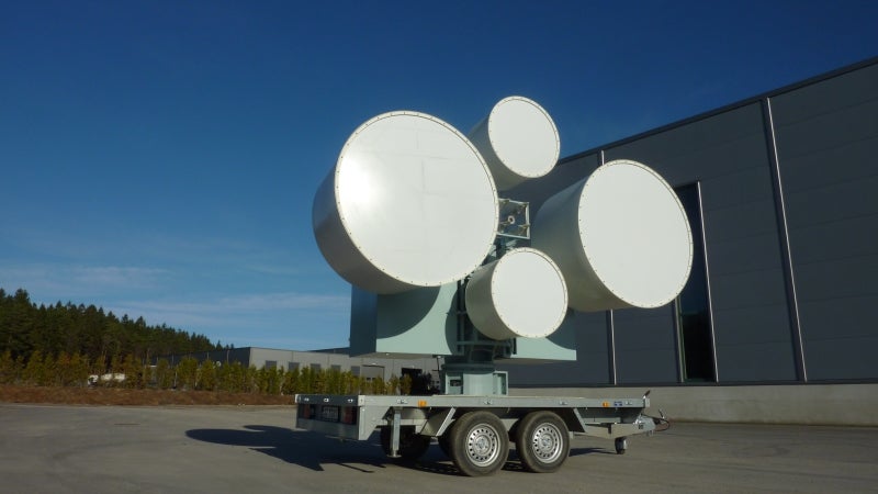
This paper presents the ISPAS dual-polarised Ku-band radar with electronically steered antennas for maritime surveillance.
ISPAS provides technology for assessment of radar cross section (RCS) of maritime stealth objects and delivers broadband radars for maritime RCS measurements.
You have successfully submitted your enquiry. Someone from our company will respond ASAP
ISPAS provides technology for assessment of radar cross section (RCS) of maritime stealth objects and delivers broadband systems for maritime RCS measurements.
ISPAS has worked in the RCS simulation and measurements sector for the last 20 years.
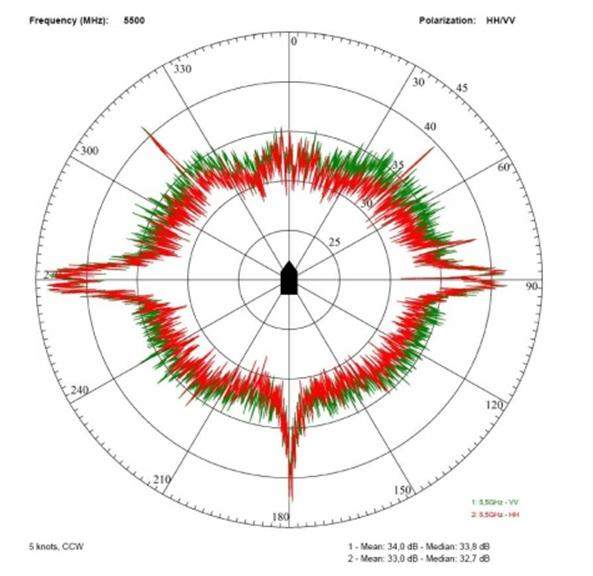
The ISPAS’s RCS radars are a very versatile measurement tool capable of operating over a broad frequency range with varying bandwidth and polarisations for measuring RCS and identification of RCS hot spots simultaneously.
The RCS measurement radar can be delivered with both optical and radio frequency (RF) tracking, as well as oceanographic and meteorological sensors for full control of the measurements.


The ISPAS RCS radar can be seen as a system for RCS measurements.
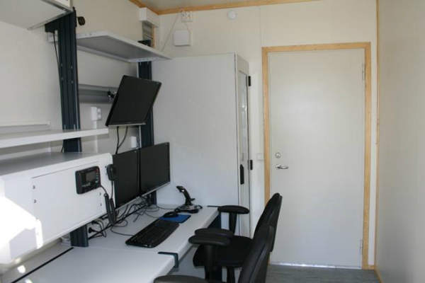
For processing of RCS data ISPAS delivers a standalone software module. The module has all the functionality of the integrated processing, delivered with the radar control module software.
The purpose of the standalone module is to be able to access measured data and process it at another location than the radar site. This is especially of interest when large data sets are handled.
ISPAS’s data processing software consists of a number of both basic and advanced data processing algorithms for data calibration, analysis, and presentation.
The module aggregates all available data from external sensors, remote positioning unit, antenna position and video, and presents them in a graphical form for easy interpretation. This allows for quality control of measured data and better understanding of target behavior.
The data can then be presented either as a function of range, time / range, Doppler / range, aspect angle, or as an inverse synthetic aperture radar (ISAR) image.
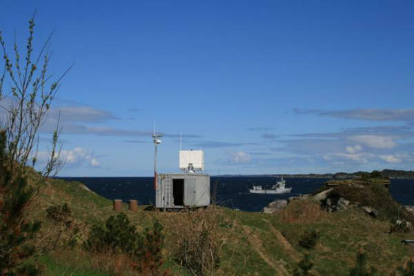
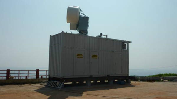
The RCS radar can be integrated in a transportable shelter for in-situ measurements at different locations.
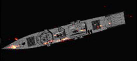
Using a 3D model of the object, the RCS can be predicted and radar hot spots identified.
ISPAS delivers tools for both calculation of material reflection coefficients and RCS.
This paper presents the ISPAS dual-polarised Ku-band radar with electronically steered antennas for maritime surveillance.
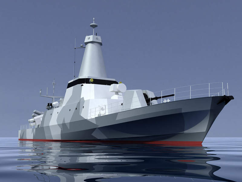
The Combattante FS56 is an advanced, long-range, fast-attack patrol vessel designed and developed by Constructions Mécaniques de Normandie (CMN).
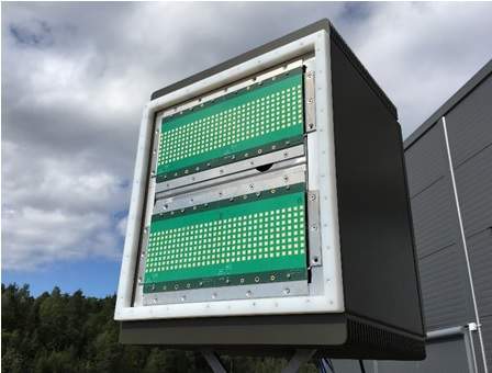
ISPAS has designed the polarimetric maritime surveillance radar with an electronically steered antenna.
The company ISPAS AS has developed a Ku-band polarimetric Oil Spill Detection (OSD) radar that can detect oil spills on sea under most sea states, even on quiet seas.
IPSAS are to present at International Defence Exhibition and Conference 2017.
ISPAS has joined the Achilles JQS. The Achilles JQS is a registration and pre-qualification community for those that supply to the oil and gas operators, and leading management contractors in Denmark and Norway.
The Norwegian Minister for Petroleum and Energy, Tord Lien, visited ISPAS on 12 January 2016 to learn about the new ISPAS OSD radar and the plans for verification under the auspices of the Research Council of Norway and in cooperation with the oil companies Lundin Norway and Statoil.
The new Oil Spill Detection (OSD) radar was successfully tested in November at the Ohmsett facility in New Jersey.
Statoil and Norwegian radar company ISPAS AS have signed contract for the installation of a new, advanced oil spill detection (OSD) radar system for the Johan Sverdrup field.