
Electronic Chart Precise Integrated Navigation System (ECPINS-W Sub) – Tactical Dived Navigation
Electronic Chart Precise Integrated Navigation System (ECPINS-W Sub) – Tactical Dived Navigation
OSI Maritime Systems has been providing electronic chart systems to the maritime market since 1979.
You have successfully submitted your enquiry. Someone from our company will respond ASAP
OSI Maritime Systems has been providing electronic chart systems to the maritime market since 1979.
The firm supply integrated navigation and tactical solutions, including integrated bridge systems for warships, C2 systems for small crafts, and integrated dived navigation systems for submarines.
OSI’s Tactical dived navigation system (TDNS) provides submariners with a wide range of navigational abilities, as well as a number of features that help to enhance the vessel’s operational ability and dived navigation safety.
These features include target motion analysis, water space management and moving havens, line of soundings fixing, bottom contour fixing, and vertical sextant angles.

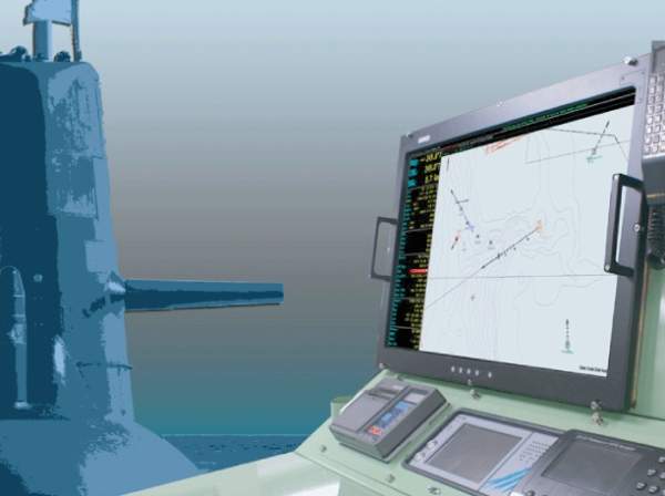
It also supplies advanced navigation fixing techniques using ENCs, as well as raster charts, and 3D chart chart display using dtandard ENC and AML / TOD data products.
The system is based on the ECPINS software, which is the most comprehensive submarine software available.
It can be integrated into a third-party hardware system, or supplied as its own stand-alone hardware, ranging across large displays, or horizontally or vertically mounted.
The TDNS is a fully-approved WECDIS, as well as being accepted as an IMO ECDIS, and certified against Nato STANAG 4564.
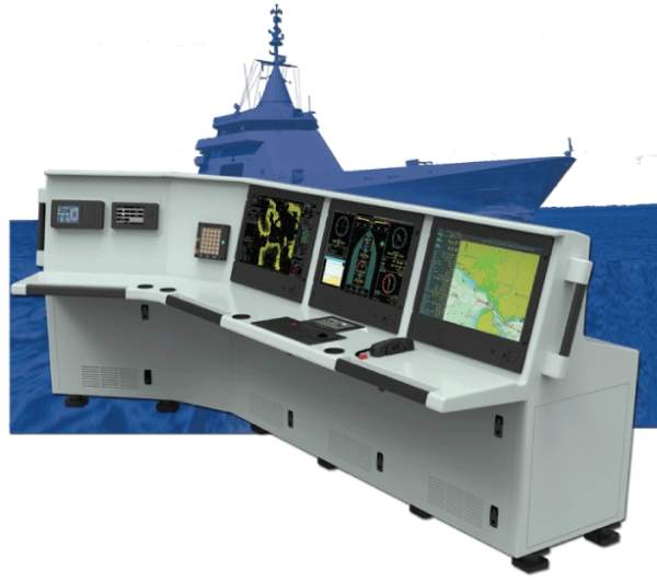
The integrated navigation and tactical system (IDNS) is an integrated bridge systems that is designed to meet the most demanding military environments.
It has a flexible design and is a fully-scalable IMO, as well as being Nato STANAG 4564 compliant.
The system is suitable for existing platform retrofits, or new builds. It integrated selected radars and navigation sensors, as well as providing a comprehensive and cost-effective IBS.
IDNS is based on OSI’s ECPINS. It has full WECDIS functionality, and is protected against DGPS / GPS denial as well as failing through battle damage.
Features and functions available within the IDNS include NavTac DDU to accept sensor data, WECDIS to help handle challenging navigational and tactical situations, and SHOL, which allows for the focus on a multiple number of tasks during flying operations.
It also supplies a The ECPINS 3D chart engine, conning display, radar and radar image overlay, and W-AIS functionality for the organisation for a detailed recognised maritime picture.
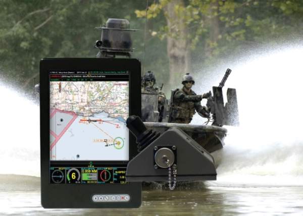
Tactical asset control and tracking (T-ACT) allows for the capture and sharting of complex situational awareness pictures. The system can also be used to help organise the operations of multiple T-ACT fitted ships and smaller assets.
T-ACT enhances the information that is gained through AIS and provides tactical advantages, as well as increased security, performance, and safety of assets, people, and equipment to military operations.
Electronic Chart Precise Integrated Navigation System (ECPINS-W Sub) – Tactical Dived Navigation
Current marine threats have proven the need to extend tactical response options beyond the mother ship to its boats and RHIBs used for security and combatant craft roles including antipiracy, antidrug, illegal trade, and border security.
Accurate navigation is crucial in today's naval operations.

The Astute-class nuclear submarines are the UK’s most advanced and powerful attack submarines.

A fleet of eight River-class offshore patrol vessels (OPVs) is in service with the UK Royal Navy.

Trafalgar Class nuclear-powered attack submarines are in service with the Royal Navy.

The Resolve-class auxiliary oiler replenishment (AOR) vessel is a retrofit of MV Asterix container vessel to support the Royal Canadian Navy’s at-sea replenishment capability.
Holland Class offshore patrol vessels (OPVs) were built by Damen Schelde Naval Shipbuilding for the Royal Netherlands Navy. A series of four OPVs are named after Dutch coastal provinces.

The Vanguard submarines were built by Vickers Shipbuilding and Engineering Limited (now BAE Systems Marine) at Barrow-in

Milgem Class corvettes are being built for the Turkish Navy under the Turkish national warship programme known as Milgem
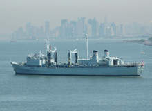
The Protecteur class auxiliary oiler replenishment ships are in service with the Canadian Navy. The class was built by S
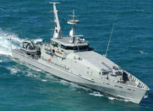
In December 2003, the Australian Ministry of Defence awarded the prime contract to Defence Maritime Services (DMS) for the supply and support of 12 Armidale Class patrol boats.
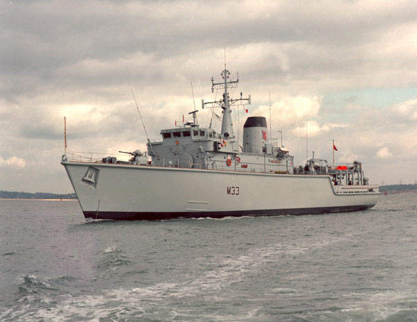
Between 1980 and 1989, 13 Hunt Class minesweepers and minehunters of the UK's Royal Navy were commissioned.
OSI Maritime Systems (OSI) will feature the company's leading naval integrated navigation and tactical solutions at the Sea-Air-Space Exposition between 13-15 April.
OSI Maritime Systems (OSI) is pleased to announce the signing of a contract to provide integrated navigation and tactical systems (INTS) for the Indian Navy Cadet Training Ship (CTS) new build project.
OSI Maritime Systems' (OSI) exhibit will feature a range of the company's leading naval integrated navigation and tactical solutions at the Langkawi International Maritime and Aerospace Exhibition (LIMA) between 17 - 21 March, 2015, in Langkawi, Malaysia.
OSI Maritime Systems (OSI) is pleased to announce the awarding of a contract to deliver tactical dived navigation systems (TDNS) for the Royal Swedish Navy A19 Götland-class submarines' upgrade programme.
OSI Maritime Systems (OSI) is proud to announce the official opening of its newest office, in Canberra, Australia.
As part of the Royal New Zealand Navy (RNZN) ANZAC Frigate programme, OSI Maritime Systems (OSI) is pleased to announce the successful completion of the Sea Acceptance Trials (SAT) of OSI's Integrated Bridge System (IBS), or Integrated Navigation & Tactical System (INTS).
OSI Maritime Systems (OSI) is pleased to announce the signing of contracts to provide the Turkish Navy with OSI's world leading Warship Navigation System, which includes ECPINS-W software.
OSI Maritime Systems (OSI) is pleased to announce the signing of a contract to provide the Royal Australian Navy (RAN) with its Ship Helicopter Operating Limits (SHOL) software module.
OSI Maritime Systems (OSI) is pleased to announce that it has signed a contract to provide in-service-support for the Integrated Navigation and Bridge Systems (INTS) that the company has delivered and installed across the Royal New Zealand Navy fleet.
OSI Maritime Systems (OSI) is pleased to announce the signing of a contract to integrate its flagship software, ECPINS-W Sub, into the UK Royal Navy's T45 Destroyer Integrated Bridge System (IBS).
OSI Maritime Systems (OSI) is pleased to announce that it has signed a contract to provide in-service-support for its ECPINS-W Sub software.
OSI Maritime Systems (OSI) will exhibit a range of the company's leading naval integrated navigation and tactical solutions at the Navy League's annual Sea-Air-Space Exposition, 7 to 9 April 2014, at the Gaylord National Resort and Convention Center in National Harbor, Maryland.
OSI Maritime Systems (OSI) announced today that it has been selected by Lockheed Martin Canada to support the design activity of the bridge and navigation capabilities for the Royal Canadian Navy's (RCN) new class of Arctic/offshore patrol ships (AOPS).
OSI Maritime Systems (OSI) announced today that it has been selected by Lockheed Martin Canada to support the design activity of the bridge and navigation capabilities for the Royal Canadian Navy's (RCN) new class of Arctic/offshore patrol ships (AOPS).
OSI Maritime Systems (OSI) is pleased to announce that it has signed a contract to provide in-service-support for its ECPINS-W Sub software.
OSI Maritime Systems is pleased to announce the award of a contract for the company's Tactical Dived Navigation System.
On 6 October 2013, OSI Maritime Systems president and CEO Ken Kirkpatrick, as a member of Prime Minister Stephen Harper's Canadian business delegation to Malaysia, participated in a ceremony recognising recent Canadian-Malaysian business agreements.
OSI Maritime Systems Ltd. (OSI) is pleased to announce that it has signed a contract to provide a Portable Warship-AIS and situational awareness system for immediate deployment across the entire UK submarine flotilla.
OSI Maritime Systems is pleased to announce the signing of a Letter of Award with Boustead Naval Shipyard, Malaysia.
OSI Maritime Systems (OSI) is pleased to announce the signing of a contract with Daewoo Shipbuilding & Marine Engineering (DSME), South Korea.
OSI Maritime Systems is pleased to announce the provision of an advanced command, control and situational awareness system to the Royal Australian Navy Amphibious Task Group.
OSI Geospatial, a world leader in naval integrated navigation and tactical solutions, announced today that it has signed a contract to upgrade the Royal Danish Navy to the newly released ECPINS 6.0.
OSI Geospatial, a world leader in naval navigation and tactical solutions, has announced the release of ECPINS 6.0 for Warships (ECPINS-W) and Submarines (ECPINS-W Sub), and the fleet-wide deployment by the Royal Navy.
OSI Geospatial is pleased to announce that it has signed a $2.2m contract with the UK Ministry of Defence to provide a fleetwide license for use by the UK Royal Navy (RN). The RN currently employs OSI's tactical navigation software and systems across 75 naval platforms, including submar
OSI Geospatial is pleased to announce that it has signed a $1.4m contract to support the OSI navigation and tactical system used fleet-wide within the Royal Australian Navy (RAN). The contract makes provision for technical support as well as software upgrades for ECPINS-W sub (electronic chart p
OSI Geospatial has announced that it has signed a contract valued at approximately $2m with Siemens to provide an integrated bridge system (IBS) for the Royal New Zealand Navy’s ANZAC class frigate platform system upgrade (PSU) programme. The company will deliver two of its integrated navigation
OSI Geospatial has announced that, after successful sea trials, the first Vanguard Class SSBN has been approved to navigate digitally. OSI Geospatial is the software supplier as part of the Lockheed Martin UK WECDIS team. This milestone achievement clearly indicates the confidence that the Royal
OSI Geospatial announced today that its international systems operations has been awarded a contract under which the company will supply its world-leading ECPINS® W (Sub) software to the UK Royal Navy’s Astute Class submarine. "This significant win in a highly-competitive situation
OSI Geospatial announced today that its International Systems Operations has achieved formal-type approval from Germanischer Lloyd for its ECPINS® software against the NATO STANAG 4564 Edition 2 for warship electronic chart and information display systems. “This very important mile
OSI Geospatial Inc. (TSX: OSI) ("OSI") announced today that its International Systems Operations has signed a contract to provide a new naval customer with its ECPINS-W Sub® WECDIS technology for trials and evaluation. The contract also includes training. Ken Kirkpatrick, president and
OSI Geospatial Inc. (TSX: OSI) (“OSI”) announced today that its International Systems Operations has signed a contract valued at approximately $1.3 million to supply its world leading ECPINS® Warship Navigation System to the Dutch Defence Materiel Organization for use by the Royal Netherlands Nav
OSI Geospatial Inc. (TSX: OSI; OTCBB: OSIIF) announced today that it has launched a new product for the military and security markets. The Asset Control and Tracking (ACT) system is a versatile and fully scalable solution based on terrestrial communications. It is designed to provide military and
OSI Geospatial Inc. (TSX: OSI; OTCBB: OSIIF) announced today that its international systems business has now signed the prime contract with the United Kingdom Ministry of Defence (MOD) to deliver Warship Automatic Identification Systems (W-AIS). On November 2, 2006, the company announced its sele