
Bouchard (OPV 87)-Class Vessels, Argentina
Argentina has acquired four Bouchard (OPV 87)-class patrol vessels under a contract signed with Naval Group in 2019.
iXBlue is a leading provider of navigation, imaging and positioning solutions for first-rank ships, submarines and autonomous underwater vehicles (AUV).
You have successfully submitted your enquiry. Someone from our company will respond ASAP
iXBlue is a leading provider of navigation, imaging and positioning solutions for first-rank ships, submarines and autonomous underwater vehicles (AUV) to the world’s navies.
iXBlue specialises in producing highly accurate navigation and control systems for maritime environments. The company’s range of four gyrocompasses and inertial navigation systems include:
iXBlue’s MARINS naval inertial navigation system is designed to provide navies worldwide with more accurate readings than conventional systems. The INS has proven itself so durable and reliable that it has gained space-quality grading standards.
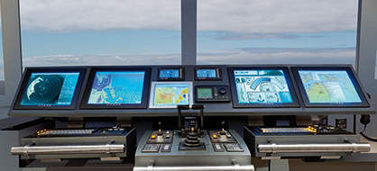
The company’s global electronic chart display and information systems (GECDIS) are produced in three variations: the GECDIS-C, GECDIS-W and GECDIS-ST. iXBlue’s GECDIS solutions comply with the latest IMO, IEC and IHO regulations. All systems monitor, process and display all information available to provide the navigator with the most up-to-date layout of the vessel’s navigation environment.


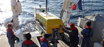
iXBlue’s subsea navigation systems are reliable and possess high connectivity to help navigators accurately plot the landscape. For naval vessels where space is a premium, the OCTAN NANO 4,000m depth-rated attitude and heading reference system (AHRS), complete with titanium housing, remains well-suited to the challenging subsea environment.
The OCTANS 3,000m-depth subsea survey-grade gyrocompass and complete motion sensor can efficiently and accurately collect navigational data. It can even be upgraded to full INS mode.
ROVINS is a survey-grade full featured inertial navigation system suitable for water depths of 3,000m. Designed specifically for offshore survey and construction works, ROVINS improves the efficiency of all operations where accurate position, heading and attitude are key benefits.
The PHINS 6000 subsea inertial navigation system (INS) provides highly accurate inertial measurement units for position, true heading, attitude, speed, depth, and heave for deepwater operations.
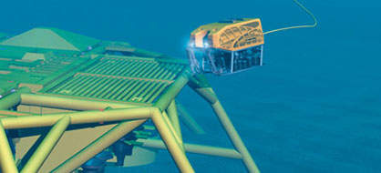
iXBlue’s high-performance ultra-short baseline (USBL) positioning systems provide accurate positioning and tracking of subsea vehicles and objects. The iXBlue Fourth Generation GAPS USBL system features a compact and all-in-one design for both portable and permanent installations.
POSIDONIA II is an ultra-short baseline (USBL) acoustic positioning system for high-accuracy and ultra-long range tracking of subsea vehicles. It offers enhanced performance with a new electronic cabinet (USBL-Box), including the most recent iXBlue acoustic signal processing and full compatibility with RAMSES 6000 synthetic baseline positioning system.
iXBlue’s two variations of long base line (LBL) positioning systems are cost-effective and time-saving systems. The RAMSES system can be quickly deployed and requires no topside computer or umbilical accessories for immediate and simplified mobilisation.
The ComMet requires no line-of-sight for its acoustics, making it particularly tolerant to masking. This versatility, combined with the additional extensive range of sub-components, makes it a suitable choice for general navigational purposes.
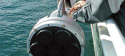
iXBlue’s range of low-frequency, medium-frequency and acoustic telecommand units of acoustic transponders are flexible, high-performance and energy-efficient systems that can be deployed for long-term operations on autonomous beacons or subsea vehicles.
The company’s signature DELPH software suite has been used by surveyors and geophysicists worldwide to acquire and interpret marine data.
DELPH acquisition software is a unified data logging solution to safely monitor and record side-scan sonar, seismic and sub-bottom profiler data in a simple user interface.
The DELPH interpretation software has the unique capability of handling vast amounts of data in a short time using batch processing, while still providing the finest details. DELPH interpretation is the ideal solution when processing time is critical.
iXBlue’s SAMS DT-6000 is a multi-mission seabed mapping sonar that combines the use of advanced synthetic aperture sonar (SAS) technology together with iXBlue cutting edge products such as PHINS 6000, POSIDONIA II and ECHOES 5000.
The flexible architecture allows easy integration with tow fish and AUV platforms. SAMS is a multi-purposes tool that enables navigators go to -1,000m or as deep as -6,000m.
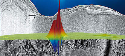
iXBlue’s ECHOES range of sub-bottom profilers are versatile solutions for accurate navigation. The systems provide low-distortion data and penetration, facilitate buried objects management, and are easy to install.
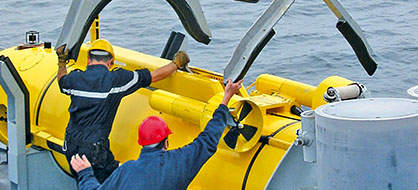
iXBlue’s pan and tilt platforms can be deployed on land and sea operations. The systems contain a real-time interface for sensor in-the-loop control and tracking capabilities that provide accurate results in an easy setup.
iXBlue’s positioner systems use a real-time interface for sensor-in-the-loop control and advanced model-based controller to pinpoint objects with high accuracy on land and sea applications. The system is MIL-STD-810G qualified, compact, portable, and has low power consumption, making it a suitable choice for all navies worldwide.
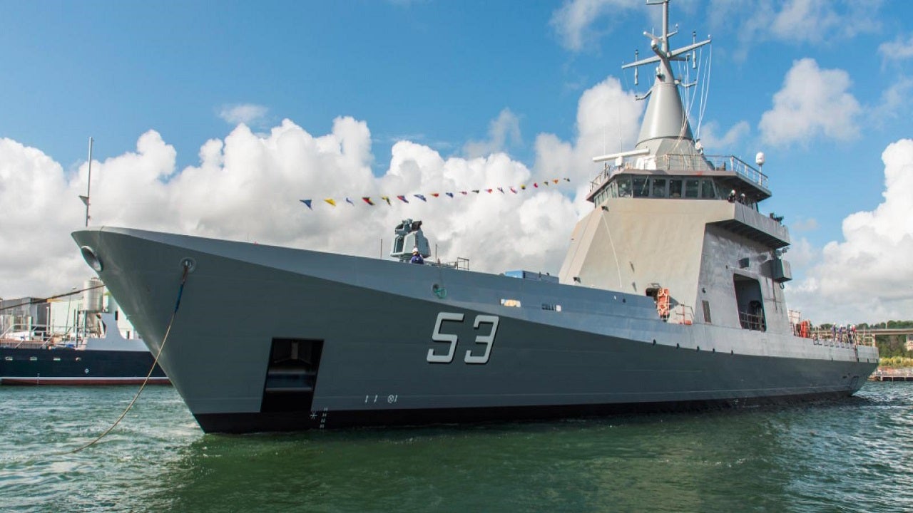
Argentina has acquired four Bouchard (OPV 87)-class patrol vessels under a contract signed with Naval Group in 2019.

RQ-20B is a block 2 upgrade of the Pointer Upgraded Mission Ability-All Environment (Puma AE) small unmanned aircraft system (UAS) designed and built by AeroVironment.
iXBlue supplies a unique warship electronic chart display and information system (WECDIS) based on an open software design that allows it to meet the individual needs of its users.
At the Sea Air Space 2017, held in Washington, DC, US, Naval Sea Systems Command (NAVSEA) drew attention to the advancement of digital solid-state technologies over MILSPEC analogue devices.