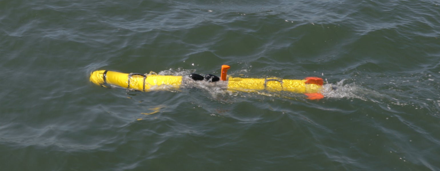
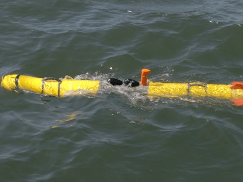
Next-Generation 300m Precision Workhorse Commercial UUV
The Iver4 PW UUV offers users a 300m depth workhorse system featuring long duration capability and no shipping restrictions with L3 OceanServer’s Lithium-free standard design.
L3Harris OceanServer is a manufacturer of autonomous, lightweight unmanned undersea vehicles (UUVs) used in military, research and commercial missions, including mine countermeasures (MCM), hydrography, intelligence, surveillance, and reconnaissance (ISR), environmental monitoring, anti-sub warfare, research, survey and search and recovery.
You have successfully submitted your enquiry. Someone from our company will respond ASAP
 L3Harris OceanServer is a manufacturer of autonomous, lightweight unmanned undersea vehicles (UUVs) used in military, research and commercial missions, including mine countermeasures (MCM), hydrography, intelligence, surveillance, and reconnaissance (ISR), environmental monitoring, anti-sub warfare, research, survey and search and recovery.
Built with leading-edge technology and a battlespace understanding, the Iver family of vehicles are capable, modular, reliable and field-proven.
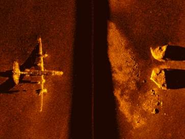
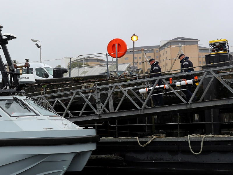
The L3Harris OceanServer Iver3-580 is a fully autonomous underwater vehicle (AUVs) capable of operating unattended for up to ten hours and 100m-200m deep while carrying a variety of sensors. The payload sensors can produce detailed bathymetry, side-scan imagery, magnetometer, water quality and camera systems (video and stills).
The Iver3 AUV is an affordable, commercial vehicle used by customers around the globe for sensor development, water quality, general survey work, sub-surface security and research.

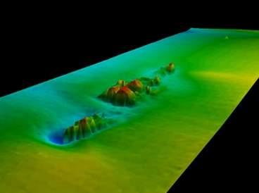
The portability of the Iver3, along with high-fidelity collocated data, makes the platform ideal for detailed water column, bottom characteristics and target information missions.
L3Harris OceanServer has partnered with essential hardware and software companies to bring the most complete UUV solution to the market for all of these requirements.
The innovative AUVs are single-person-portable and include simple point-and-click mission planning. The on-board rechargeable battery allows the system to operate for ten hours (depending on environmental conditions and payload) and supports battery section swapping for continuous operation. With this endurance, the Iver3 is capable of covering more than 20km (12 miles) of survey lines on a single charge.
The Iver3 can be rapidly programmed and deployed to search a large area with little time or effort by the operator. The platform uses a series of sophisticated sensors to navigate the pre-programmed path while maintaining a constant height off the bottom, regardless of the water conditions.
The Iver4 PW UUV offers users a new 300m workhorse system featuring long duration capability and no shipping restrictions with L3Harris OceanServer’s lithium-free standard design.
The Iver4 comes standard with rechargeable NiMH battery packs supporting up to 20hrs of runtime or > 74km mission duration for long ingress/egress missions.
The Iver4 PW is the first in a family of advanced UUVs to address a wide variety of customer missions, including defence applications such as multi-domain intelligence, surveillance and reconnaissance (ISR), anti-submarine warfare (ASW), as well as seabed and mine warfare.
This new system offers survey customers a commercial platform that can be easily shipped on common carriers without the concern of hazardous goods shipping.
The Iver4 comes standard with industry-leading tracking and safety communications, precise repeatable measurement, high-accuracy navigation, as well as low-drag side scan and bathymetry transducers.
Vector Map software supports mission planning for multiple vehicle missions on any geo-referenced 2D surface, S57, UAV Images, or raster charts. All missions are planned using simple point-and-click methodology.
Following mission completion, VectorMap can be used to log data and plot or export data from other tools. Mission reports can be generated in minutes. VectorMap has a full-contact manager tool for marking sonar targets and other items of interest. All sensor data can be overlaid on VectorMap during post-processing.
Since 2003, L3Harris OceanServer has proven itself within a developing specialised market, providing highly efficient UUVs to a wide range of military, commercial and international clients.
L3Harris Technologies is an agile global aerospace and defence technology innovator, delivering end-to-end solutions that meet customers’ mission-critical needs. The company provides advanced defence and commercial technologies across air, land, sea, space and cyber sectors.
At L3Harris OceanServer, customer support is the cornerstone of our business and is available 24 / 7, 365 days a year. L3Harris OceanServer has sold more than 300 units worldwide.
The Iver4 PW UUV offers users a 300m depth workhorse system featuring long duration capability and no shipping restrictions with L3 OceanServer’s Lithium-free standard design.
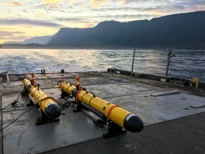
Iver4 900 is a new unmanned underwater vehicle (UUV) developed and manufactured by L3Harris OceanServer.
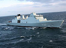
The Ivar Huitfeldt Class frigates were built by Odense Steel Shipyard for the Royal Danish Navy.
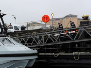
L3Harris Technologies has received an order to upgrade three Iver3 Autonomous Underwater Vehicles (AUV) to be used in support of the Royal Navy’s Project Wilton.
The US Navy and the Defense Innovation Unit (DIU) has selected L3Harris Technologies to provide an unmanned undersea vehicle for expeditionary undersea missions for US military forces.
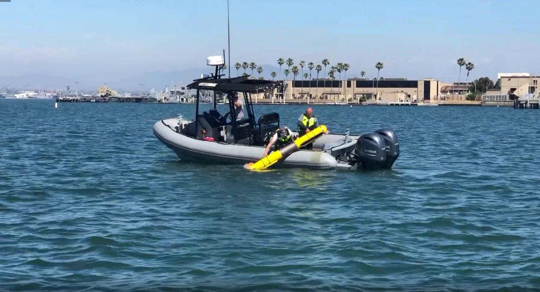
L3 Technologies announced that its Iver4 Unmanned Underwater Vehicle (UUV) completed a mission lasting more than 14 hours in San Diego Bay, California, US.
L3 OceanServer has been granted a five-year General Services Administration (GSA) schedule for its Iver3 Unmanned Undersea Vehicles (UUVs).
L3 OceanServer has been contracted to support the US Marine Corps Systems Command with an Iver3 Unmanned Underwater Vehicle (UUV).
L3 OceanServer, a developer and manufacturer of autonomous underwater vehicles (AUVs), announced today that it has recently added 4,700ft2 of space at its headquarters location in Fall River, Massachusetts, US.
L3 OceanServer has announced its successful participation in the Advanced Naval Technology Exercise (ANTX), an annual event held at the Naval Undersea Warfare Centre in Newport, Rhode Island, US, where the future of naval technologies is demonstrated.
OceanServer Technology recently participated in the first ever Unmanned Warrior (UW) in Loch Alsh, Scotland.
OceanServer Technology, the leading manufacturer of commercial Autonomous Underwater Vehicles (AUVs), recently announced the continuation of a successful ten-year partnership with the launch of the next-generation EcoMapper.
OceanServer Technology announced today that it has received eight new Iver3 AUV orders for delivery to a variety of survey, research, military and water quality organisations.
SeeByte, the global leader in creating smart software for unmanned maritime systems, is pleased to announce that it has received an order from the United Kingdom's (UK) Ministry Of Defence (MOD) Defence Equipment and Support (DE&S) to deliver a maritime autonomy demonstration system.
OceanServer Technology has received orders for six new Iver autonomous underwater vehicle (AUVs) from three different customers.