Marine robotics company Sonardyne International has demonstrated technologies that will assist autonomous vehicle operations in challenging environments as part of a project funded by the UK’s national Defence and Security Accelerator (DASA).
This demonstration was aimed at fast-tracking autonomous vehicle capability in challenging or harsh conditions.
Go deeper with GlobalData

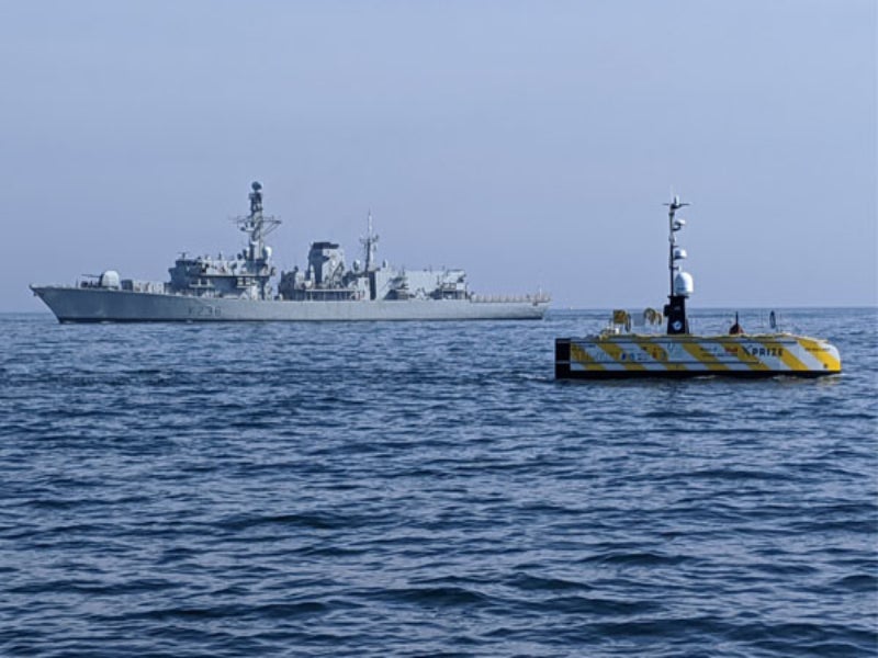
The company has validated sensors already used by unmanned underwater vehicles for use on unmanned surface vehicles (USV) in support of missions in coastal waters.
Sonardyne’s SPRINT-Nav hybrid inertial navigation instrument was integrated into a 12m-long SEA-KIT X class (USV) and was tested against local real-time kinematic (RTK) GPS positioning.
SPRINT-Nav, which can operate in GPS or GNSS denied environment, is claimed to be a reliable navigation instrument for unmanned underwater vehicles.
Additionally, it can provide a USV with high integrity and continuously available navigation solution for operating in littoral zones in water depths of up to 150m.
How well do you really know your competitors?
Access the most comprehensive Company Profiles on the market, powered by GlobalData. Save hours of research. Gain competitive edge.

Thank you!
Your download email will arrive shortly
Not ready to buy yet? Download a free sample
We are confident about the unique quality of our Company Profiles. However, we want you to make the most beneficial decision for your business, so we offer a free sample that you can download by submitting the below form
By GlobalDataSonardyne Defence and Marine Robotics global business manager Ioseba Tena said: “Most USVs rely on uninterrupted GPS or GNSS signal updates to inform their situational awareness and plot a course safely.
“When there’s no signal, or what’s called spoofing or jamming, USVs must consider alternative navigation sensors and instruments or they need to be remotely piloted, adding expense and risk to over-the-horizon operations.
“By integrating SPRINT-Nav onto a USV, such as SEA-KIT, we have shown we can overcome this challenge, providing a continuous and resilient navigation in denied environments capability that will be ideally suited to challenging operations, such as mine-counter measures (MCM).”
SEA-KIT is well equipped for naval missions, including intelligence gathering, hydrographic survey, and as a communications gateway.
It is a 10,000 nautical mile-range vessel with the capacity to carry around 2.5t of payload and deploy and recover autonomous underwater vehicles (AUVs), as well as remotely operated vehicles (ROVs).