
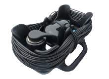
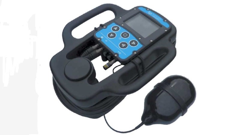
Blueprint’s GPS Navigator is a handheld device that can be used by commercial, research and search-and-rescue divers to navigate between specific underwater areas, while the device can also be used to gain access to a GPS-based fixed position.
Navigation and positioning information is received via a small float containing the GPS antenna, and relayed to the Navigator display through a thin tether cable.
Prior to diving, software running on a Windows PC is used to create mission files containing waypoints and markers that can assist the diver to navigate a search-pattern or efficiently swim between locations.
An immersion sensor automatically controls logging of the dive data to the Navigator’s internal storage memory, while the diver’s position, heading, depth and course history are shown on the Navigator’s display. Additional information for the currently selected mission marker is shown along with course-to-swim and distance to the marker.
The diver can add additional points of interest during the dive and these, along with the course and depth history, can be reviewed post-dive.
The Navigator has a simple and intuitive user interface allowing the Diver to quickly interpret information presented via the 3.5in colour display, simple menu interface and five-button keypad.
Powered using a compact rechargeable nickel-metal hydride battery pack, the Navigator will operate for over ten hours from a single charge, while battery packs can be easily swapped on the surface between dives in a matter of minutes.
Swim guide
Regardless of the main display being shown, the status bar is always visible along the bottom of the screen.
In addition to a selection of coloured status icons (showing power, GPS, logging and immersion states), the status bar also provides the diver with ‘heading to swim’ directions for the currently selected navigation destination.
If the diver is more than 30°, 60° or 90° off the desired heading, one, two or three arrows indicate respectively that they should turn either left or right.
Below 30°, a circular ‘bubble’ moves across the status bar to allow fine tuning of the course.
Missions and dive logs
The Navigator is supplied with a PC Windows software application that is used pre-dive to create mission files to configure the console with navigation marker locations (waypoints, targets of interest etc) and post-dive to review position data collected in dive-log files, with additional targets marked during the dive.